Dream Hikes
--- with Maps
|
|
Dream Hikes
|
|
(2008 Dec blog post)
! Note !
I may add info on more dream hikes ...
and info on shorter hikes ... and more maps ...
and links to other pages and map sources
--- if/when I re-visit this page.
|
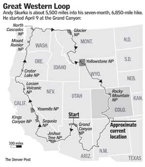
INTRODUCTION : I ran across an image of a huge Western USA hiking loop that I did not know about --- the Great Western Loop --- a trail covering California, Oregon, Washington, Colorado, and Arizona (map below).
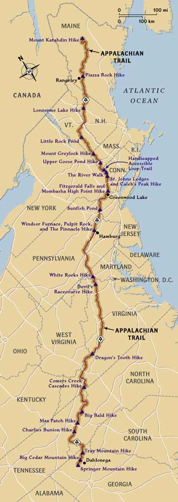
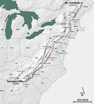
I had heard a lot about the Appalachian Trail (abbreviated as 'AT') --- especially since I live on the East Coast and I know someone who has hiked the northern part of the AT, through Vermont and Maine. (see AT map below) |
|
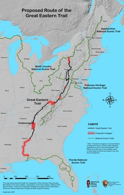
Great Eastern Trail I even ran across a map (below) of a proposed 'Great Eastern Trail' that would extend the AT.
In thinking about these massive 1,000-mile-plus trails, I got to thinking about how I would like to hike at least some major portions of these trails --- and perhaps even set out on a hike across the United States someday (in retirement). To help gather information for such a dream hike (or hikeS), I started this page --- to collect maps, info, and links to more info. |
|
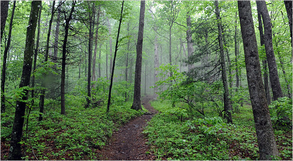
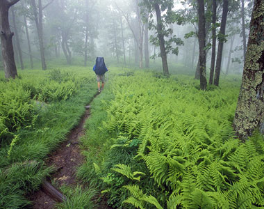
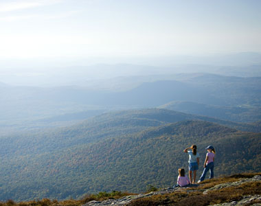
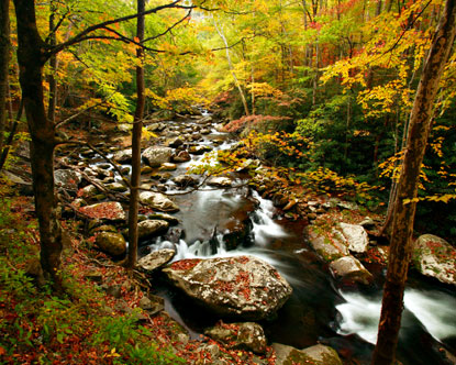
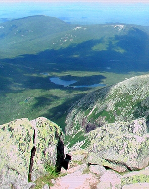
Some hikes I have done At this time (2008dec), the page is just a collection of a few map images of a few major trails --- and a collection of a few photographs that remind me of a few short hikes that I have done along or near the AT --- at locations like
|
|
Western U.S. hikes I also took a couple of memorable hikes, with the wife and kids, in the early 1990's, down into the Grand Canyon in northern Arizona. It is an AMAZING (! ! !) view when you first drive up to an edge of the canyon. Thank you, Teddy Roosevelt and other champions of national parks, monuments, and wildlife areas. And in May-June of 2007, I drove across the USA and up the west coast and saw many areas that I would like to hike, like
In my drive across the country, I basically followed Interstate 40, which parallels the famous old Route 66 in the western U.S. Fragments of 66 remain. That drive, and the fragments of 66, caused me to daydream about hiking across the country following 40 and/or 66. Those daydreams led to dreams for a wheeled, hand-or-shoulder-drawn carrier for tent and other camping gear ... and dreams of how to steer clear of highway traffic and the danger of being hit by drivers who are drunk, striken by heart attack, distracted by talking on cell phone, sociopathic against hikers/runners/bicyclers/motorcyclers, or whatever. This page is mostly the stuff of dreams --- but hopefully some of them will come true. |
|
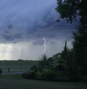
Hiking preparations Of course, one must make proper preparations. For example, one must be prepared for bad weather --- like rain and lightning. I was once running in hilly Iowa farmland countryside during a lightning storm, and I can tell you that it is not a pleasant feeling. You feel like you are a lightning rod just waiting to be struck. So this page will probably include info on hiking-camping check-lists --- someday. In the meantime, here is a page of links to hiking-camping related web sites.
A Thank-you to some (and Hands-off By the way, thank you, dreamers and do-ers, dead and alive and future, for making and preserving our national parks --- and wildlife,forest,etc. nature-preserve areas. And ... 'Freemarket capitalism freaks', leave these national treasures alone. These are treasures that 'freemarket capitalism' will destroy. These lands are symbols of why there are other things in this world just as important as (if not important than) 'freemarket capitalism'. This is especially addressed to you guys in the all-pervasive 'conservative' media, spouting your 'freemarket capitalism is the best path to prosperity' poison on CNBC ( Larry Kudlow, et. al.). I will have blog posts and 'hall of shame' pages on this site dealing with these people. In driving across country on Interstate 40, I saw first-hand in northern New Mexico, between Albuquerque and Gallup, what our parks (Yellowstone, Yosemite, et. al.) would look like if 'freemarket capitalism' were allowed to 'develop' the parks. Namely, I saw a beautiful red butte with advertising signs painted all over it in white paint --- signs advertising the indian curios shop, decrepit and decaying at the foot of the butte. And there is always some free-market, no-regulations knuckle-dragger lobbying to turn the Grand Canyon area into an oil shale or tar sands mine. There are very good reasons for regulations, you CNBC and Fox-News guys. If that is socialism, then thank God we have some elements of socialism in certain sectors of society that need protection from the worst impulses of 'freemarket capitalism'. 'Freemarket capitalism' is not the answer to everything --- not by a long shot. |
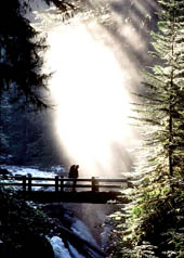
Here are a couple of more AT maps ---
to whet my/your appetite.
(And there are a few more photos at the bottom of this page.)
|
More hiking info : Since I may not get back to this page to update and enhance it, here are some WEB SEARCH links that can be used to find information on more 'dream hikes'.
|
|
Bottom of this
To return to a previously visited web page location, click on the
Back button of your browser, a sufficient number of times.
OR, use the History-list option of your web browser.
< Go to Top of Page, above. >Or you can scroll up, to the top of this page. Page history:
Posted this page 2008 Dec 24.
|
More Appalachian Trail images :
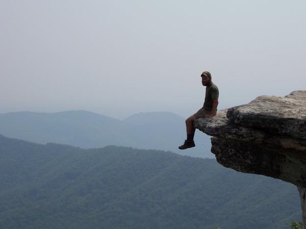
Not recommended.
(This guy is probably assuming too much.)
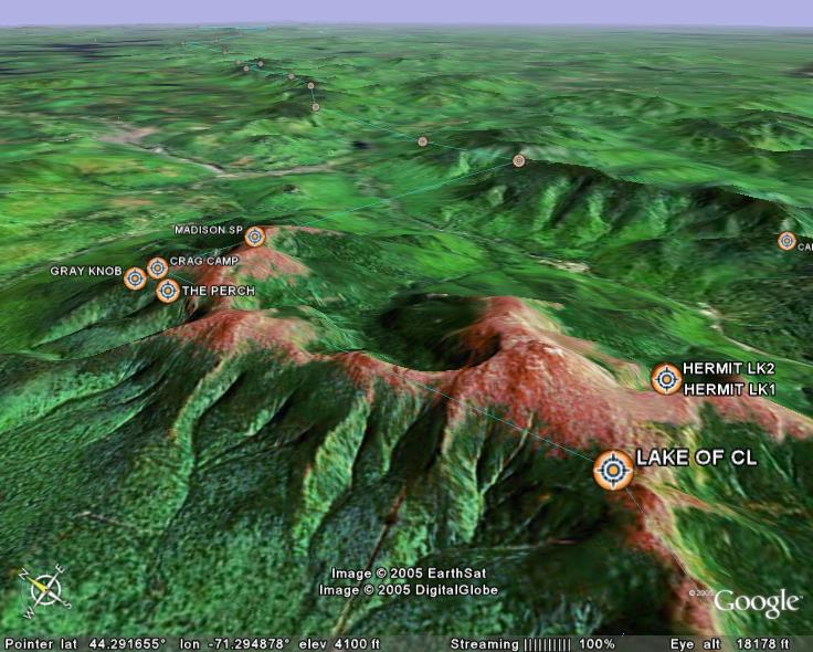
'Gray Knob', 'Crag Camp', 'the Perch' and 'the Log Cabin' are
four AT "camps" or shelters located on the north slopes of
Mt. Adams in the White Mountain National Forest, near
Randolf, New Hampshire