OSM Maps
Countries of Earth
Various Zoom Levels
'Snappy Maps'
(OSM = Open Street Maps)
OSM MapsCountries of Earth
Various Zoom Levels
(OSM = Open Street Maps) |
|
! Under construction !
Initially each 'OSM tile at z,x,y' link is to
a single tile containing (most of) the country.
Eventually the single tiles are to be
replaced by a zoomable capability
--- a 'snappy map' capability ---
for the 190-plus countries of Earth.
< Go to Table of Contents, below >
(SKIP THIS INTRO)
|
INTRODUCTION : This site presents a Cities and Countries 'Slippy Maps' page. That page consists of links to 'slippy maps' --- for about 1,200 cities and countries. Those are links to the 'openstreetmap.org' home page with a latitude and longitude and zoom-level specified --- appropriate for an initial view of each city and country. The 'openstreetmap.org' home page uses some complex JavaScript --- consisting of hundreds of JavaScript functions --- to allow the user to pan and zoom an OSM 'slippy map'. The OSM slippy map is made up of 256x256 pixel PNG file 'tiles', which cover most of Mother Earth --- at about 18 different 'zoom-levels' --- each zoom-level twice as magnified as the previous one.
You can see more detail about the OSM tiles in several sections of the Cities and Countries 'Slippy Maps' page reference above. Sections: Those hundreds of JavaScript functions used at the OSM site support many additional features (besides zoom in, zoom out, and pan) such as allowing for
The OSM tiles around a given latitude and longitude (and zoom-level) can be displayed in a web page using URL's of the form: https://www.openstreetmap.org/#map=z/lat/lon where z is an integer zoom-level, and lat and lon are latitude and longitude, in decimal degrees. Example: https://www.openstreetmap.org/#map=4/38.0/-97.0 I can see that, if one simply wants to be able to explore a map (without features like adding markers and notes), there is a possibility of navigating around a map with 3 simple functions
To do this, using the OSM 'tiles', it is possible to write 3 JavaScript functions (that take parameters z, lat-tile-integer-ID, lon-tile-integer-ID) to build new map views of those three types. An additional JavaScript function will be needed to act as a 'wrapper' to those 3 functions --- in order to ask the user which of those three new-map views to create --- when the user clicks on a map tile. At least one more JavaScript function may be required if we want to offer the user a choice of different tile servers to use. Non-OSM tile servers have different server names --- and they often use a slightly different format to pass the z,lat,lon parameters to the tile server. This JavaScript function --- when passed a tile server ID --- can build the appropriate URL to fetch a tile from that tile server. I call this kind of map exploration 'snappy maps' --- instead of 'slippy maps' --- because the navigation is reminiscent of snapping icons to a grid structure on a desktop --- but, instead of desktop icons, we are dealing with map 'tiles'. Furthermore, we will be dealing with jumping around (on and to) an array of map tiles --- say, 2-by-2 or 3-by-3 or 4-by-4 tiles --- instead of smoothly scrolling over tiles and parts of tiles at the edges of the window. In this 'snappy tile' implementation, we will always be dealing with whole tiles --- an integral number of tiles. So our map view will always be a multiple of 256 pixels --- horizontally and vertically. I was hoping to get the 'snappy tile' Javascript code written soon. However, it may be a few years (perhaps 2020 or beyond) before I return to this page and write that Javascript code. In the meantime, there are 'OSM Slippy Tile' links below that provide the more 'feature-full' OSM slippy tile map facility. With 'snappy tile maps', I hope to be able to do essentially the same thing that can be done with 'slippy tile maps' --- namely : EXPLORE THE WORLD! This one web page is meant to facilitate that --- in a 'snappy' way, instead of in a 'slippy' way. Island hop. Continent hop. Without jet lag. For example, island hop from Malta to Sicily (part of Italy) to Sardinia (part of Italy) to Corsica (part of France). Then explore Rome and the Amalfi coast (in Italy). Hop over to Venice (in Italy). Then visit the country of Croatia. And, after that, visit the islands of Greece. Then explore Istanbul (in Turkey) and Cairo (in Egypt). You can use a find-text-in-this-page option of your web browser to find the names of these countries in this web page. You could try doing all the navigating from the initial Malta map. OR, you could use the Malta map link. Then the Italy map link, Then the Croatia map link. Then the Greece map link. Then the Turkey map link. Then the Egypt map link. Since each country-map-link opens in a separate window (or tab), you can keep open those you need to help with navigation, and close those that you no longer need. AND, you can keep the window containing this page open, to use other country links. Follow the streets of exotic cities of the world. Follow the highways between those cities. If following a highway takes you to another country, you can use a country-link on this page to take you to the middle of that next country --- or keep panning (re-centering) your current map. Country Data : (some sources of latitude-longitude data) There are about 240 'countries' or 'administrative areas' on Mother Earth --- although some are not totally self-governing. Some are 'protectorates' and various other vestiges of colonial times (colonizations/take-overs by the U.S., English, Spanish, French, Dutch, Portuguese, Belgians, Italians, Turks, Austrians, Germans, Danish, Australians, China, USSR, etc.). Some examples of 'vestiges':
Various lists of 'countries' ('administrative areas') can be seen at Wikipedia
and at other sites such as the Database of Global Administrative Areas (GADM). You can look for other lists, along with latitude-longitude data, with a
WEB SEARCH on keywords such as It will generally be easier to find the latitude-longitude coordinates of a major city of the countries rather than the coordinates of the 'geographic center' of each country --- although the Wikipedia web pages on countries seem to have good coordinates that are at or near the center of each country. In any case, the latitude-longitude coordinates for each country below may be approximate --- but they are intended to get us 'into the ball park'. Organization of this page: I considered organizing the links to countries (and their maps) within groupings --- by about six or seven 'continents' or 'regions' of the world --- such as North America, South America, Europe, Asia, Africa, Oceania. But I decided to simply order the country-links down this page, alphabetically, by their English (U.S. English) names. This avoids issues such as whether to categorize a country as European or Asian. Nature of the links below: When you click on a link (indicated by a triplet of integer numbers: 'z,x,y'), a tile (or, eventually, a rectangular array of tiles) will be shown in a separate window (or tab) of your web browser.
NOTE: Fortunately, OSM provides alternative tiles ('Transport' and 'Cycle' style) with SOME labels in English, as well as in the local language-and-alphabet, for the Middle Eastern and Asian (and other) countries. Alternatively, there are a few other organizations that provide tile servers whose tiles have English labels. Those organizations seem to come and go --- probably burned out by all the processing (and commitment) involved in keeping the tiles up-to-date. The electric bill for all the computer processing --- that their 'tile rendering farms' do to repeatedly update billions of tiles --- must be something to behold. That is more heat generation to add to the atmosphere --- along with all the 'bitcoin' mining-processing --- and all the furnaces and combustion engines of the world. As we see in the numbers-of-tiles section referenced above, if OSM (or any other tile-rendering organization) is to supply a package of tiles, all with English labels, that generosity would require 91 billion tiles. And if you repeat that for French, German, Spanish, Russian, Greek, Hungarian, Hebrew, Vietnamese, and about 40 (?) other languages, you are talking a lot of tiles --- and a lot of terabytes --- and a lot of processing to continually regenerate the tiles from updated OSM 'base' files containing a variety of 'raw' data. (A lot of that data is not seen in the tile images.) Since some 'tile rendering farms' may do a nicer job with English-language labels on the tiles (nicer than the various OSM styles), this page may be updated someday to provide some alternatives to using the 'tile server' facility at 'openstreetmap.org'. You can go to the 'Servers' section at the bottom of the Cities and Countries 'Slippy Maps' page to see examples of some possible alternative tile styles. Besides the 'snappy-map'-links below, there are Wikipedia country-info links. If you need more information on a country, you can click on the country name to go to a Wikipedia page for the country. You can follow further links on the Wikipedia page for even more info.
UNDER CONSTRUCTION:
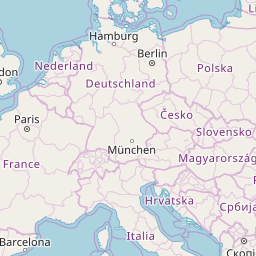
ALSO UNDER CONSTRUCTION: Enough with the intro. Below is the 'Table of Contents' --- the alphabet. For a country whose name starts with a given letter of the alphabet, you can jump to a corresponding section of country-links on this page by clicking on the appropriate letter of the alphabet. Or simply scroll down this page. When you get to a country of interest, simply click on the 'z,x,y' (3 integers) link at that country name and an OSM map tile (256x256 pixel PNG file) will appear. That tile is intended to contain (most of) the country within the tile. (Eventually, an array of tiles is to appear --- instead of a single tile.)
EVENTUALLY: Note that the initial zoom level for the larger countries will be 2, 3, 4, or 5. For small islands, the initial zoom level could be like that suitable for medium-sized to small cities --- about 12, 13, or 14. |
Table of Contents:(links to sections of this page, below)
(The links-to-maps are in alphabetical order by
A
B
C
D
E
F
G
H
I
J
K
L
M
End of Table of Contents.
< Go to Top of this page. > |
A
< Go to Table of Contents, above. >
B
< Go to Table of Contents, above. >
C
< Go to Table of Contents, above. >
D
E
F
< Go to Table of Contents, above. >
G
H
< Go to Table of Contents, above. >
I
J
K
< Go to Table of Contents, above. >
L
M
< Go to Table of Contents, above. >
N
O
< Go to Table of Contents, above. >
P
Q
R
S
< Go to Table of Contents, above. >
T
U
V
W
Y
Z
|
|
The plan is to make each of the country-maps zoomable in the sense that:
A JavaScript function that builds and displays an array-of-tiles web page --- for a given set of z,x,y numbers --- and a given tile server name --- will be used to build and display each succeeding zoomed-in web page. In addition to zooming in, it will be quite useful to be able to zoom out --- and to 're-center' a display (similar to a 'pan' function). The plan here is basically to make 'zoomy-and-re-centery maps', but not 'slippy maps'. For short, they will be called 'snappy maps'. There can be some advantages to these 'snappy-maps' --- such as a much smaller JavaScript functions library to do the map navigation. And, such as making it rather easy to capture maps in a single (large) rectangular PNG image file --- in a 'more precise' way than is typically available with 'slippy maps' --- an 'edges always on tile boundaries' way.
NOTE1:
NOTE2: Unfortunately, in OSM forums and programming forums, people keep asking for guidelines on what constitutes too many tiles to ask for at a time --- but they get no clear guidelines from OSM --- in the forums or in the OSM web pages (in 2018). I think the 9-tiles-at-a-time limit seems reasonable. They put me (and many others) in the position of guessing. That said, I can see in the OSM 'slippy maps' utility that, when the tiles are slow to draw, in my web browser, there are at least 8 tiles being used to do each OSM slippy map display in the OSM window. So a maximum of 9 tiles 'at a time' seems to indeed be a reasonable limit. Some alternate 'open' tile servers may be utilized in the future --- using URL's such as http://tile.stamen.com/#toner/{z}/{x}/{y}.png. In fact, for some of the single-tile country images above, I used the 'toner' tiles at stamen.com to get English text labels --- especially for Middle East and Asian countries. Initial z,x,y integer values for the countries : A 'MAPtools' 'tkGooie' script at freedomenv.com was used to determine an appropriate zoom-level integer and x,y integer values to use for a given decimal-degrees latitude-longitude location of a country. The 'z,x,y' integer values for each country above are intended to be used to eventually choose an initial multi-tile map position for each country, from which to navigate (zoom-in, zoom-out, and re-center). Thank You : I would like to thank the people at OSM --- and stamen.com --- for making tiles available on their servers --- tiles rendered using the 'raw' data files and image renderers that they maintain. Their 'open' attitude makes it possible for others around the world to experiment with various ways of presenting the data. |
|
Bottom of this page of
To return to a previously visited web page, click on the
Back button of your web browser a sufficient number of times.
OR, use the History-list option of your web browser.
< Go to Table of Contents, above. >
Page was started 2018 Jun 14.
(About 100 'z,x,y' tile location integers |